Loading... Please wait...
 Categories
Categories
Brands
Brands
Hiking the Zoar Trail, Newtown CT
Posted by on
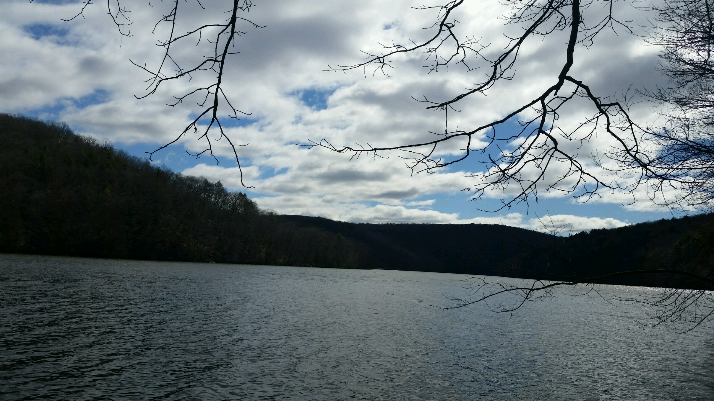
Zoar Trail - Paugussett State Forest (Lower Block), Newtown CT
A CT Forest and Park Association Blue Blazed Trail
Distance: Loop Hike approximately 7 miles (including side trail to Prydden Falls)
Date of Hike: 4/8/2017
Weather: Cool 39 degrees with moderate wind
Elevation: Lowest 157ft, Highest: 719ft
Duration: Around 5 hrs (with numerous stops for pictures, snacks, and breaks)
Difficulty: Moderate to challenging
Parking: Ample parking is available(go all the way to the end of the road) Address for your GPS: 999 Great Quarter Rd Sandy Hook, CT 06482
Trail Map:http://www.ct.gov/deep/lib/deep/stateparks/maps/paugussettsouth.pdf (follow the Blue - Zoar Trail)
Description: The Zoar Trail was an adventure! With numerous rocky scrambles, several significant inclines/declines and numerous stream crossings(one of which my wife took her shoes and socks off and waded in knee high water to cross as the main trail route was impassable because of recent heavy rains), it was a hike we won’t forget!
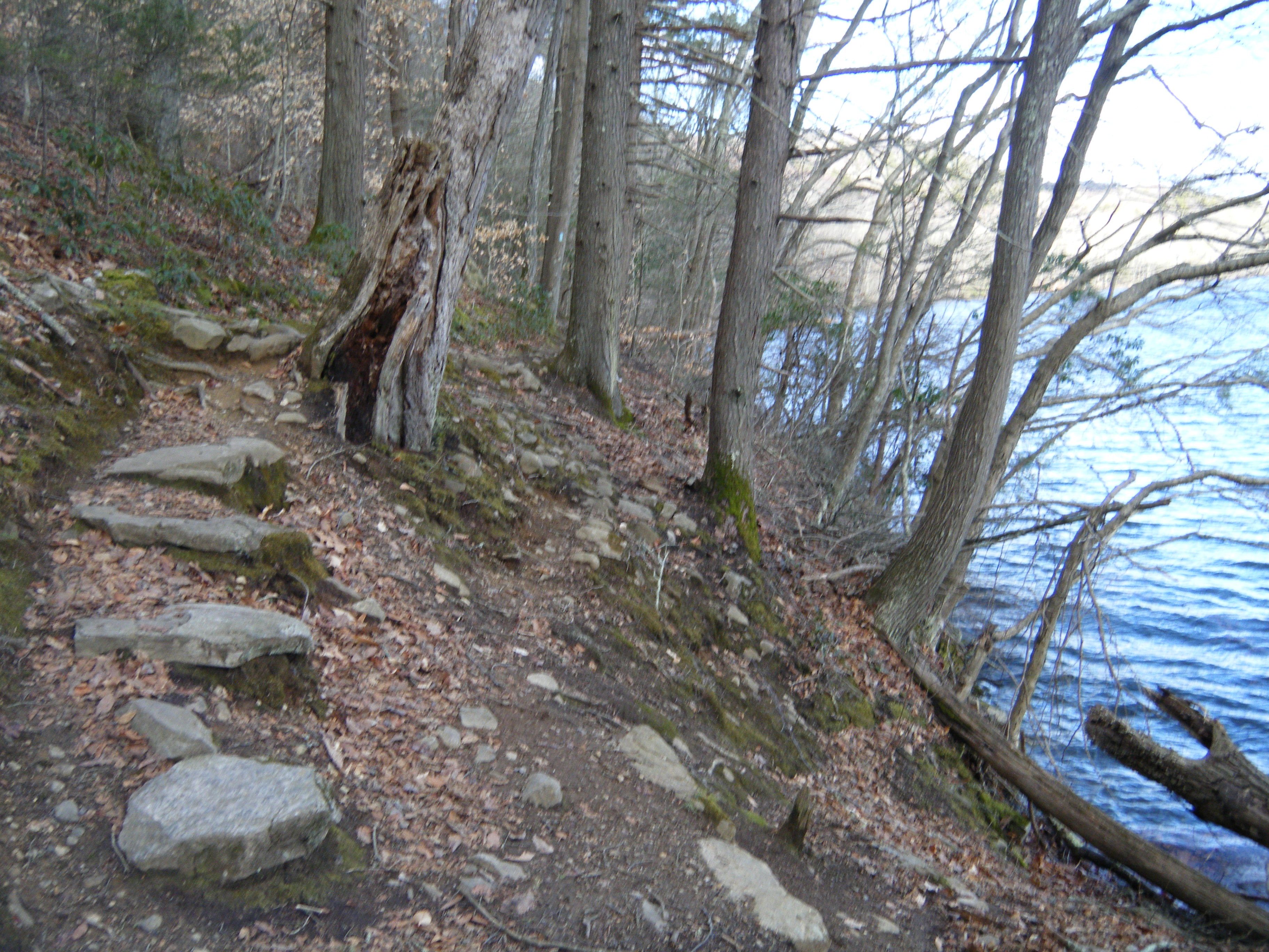
We started from the main parking lot at the very end of Great Quarter RD and followed the blue trail to the right toward the river bank(Housatonic River/Lake Zoar). The trail hugs the river for a couple miles and started out easy but traversed some rocky ledges that required more caution. Views of Jackson Cove Recreation Area and Kettletown State Park can be seen across the river.
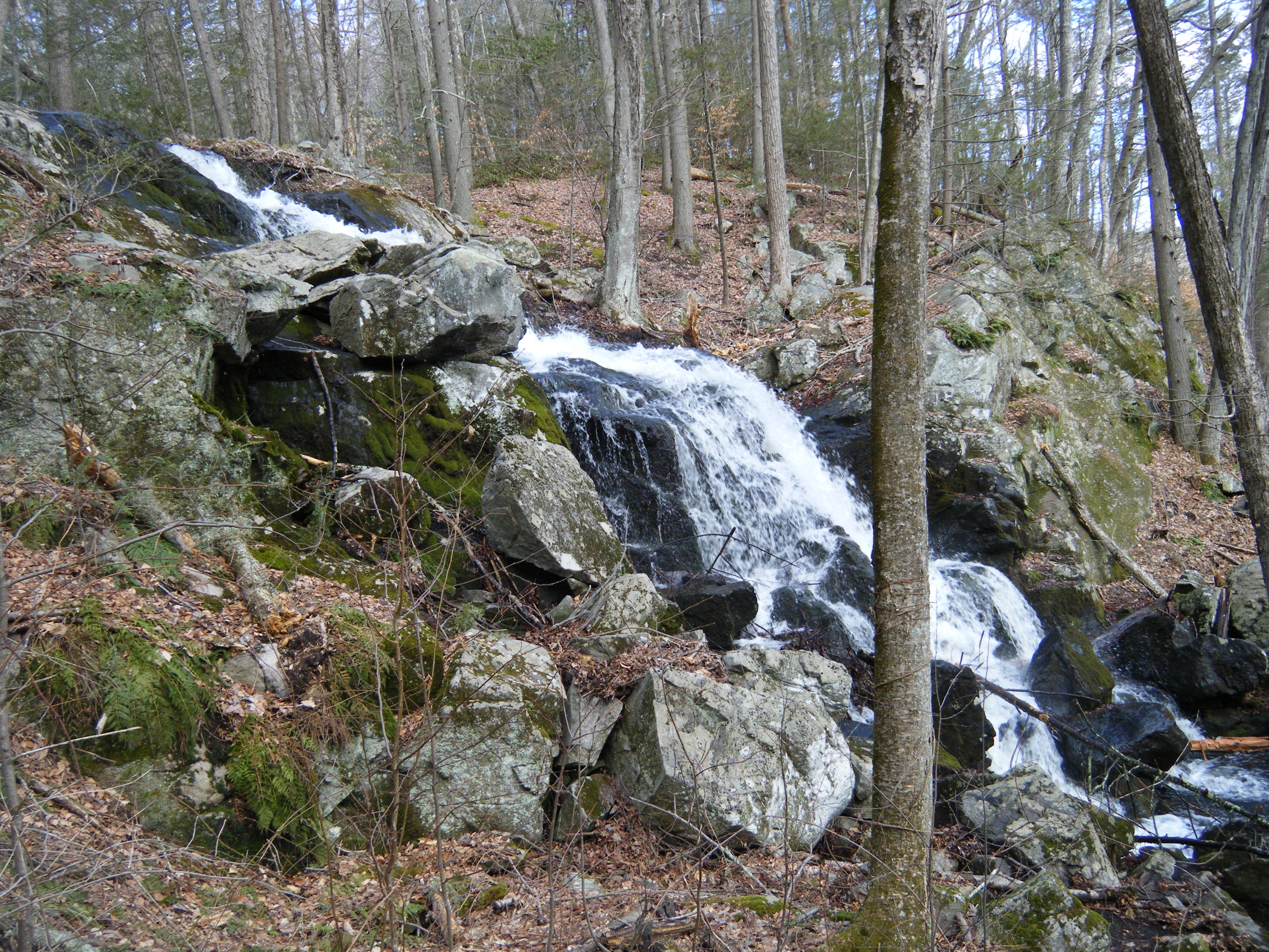
Be sure to take the side trail to Prydden Falls(unmarked trail and/or blue-yellow trail)(just follow the sound of the falls and you will find them), perhaps the highlight of this hike. We were lucky to see the falls after some recent heavy rains so the falls were impressive and this is a great spot for a snack/lunch break.
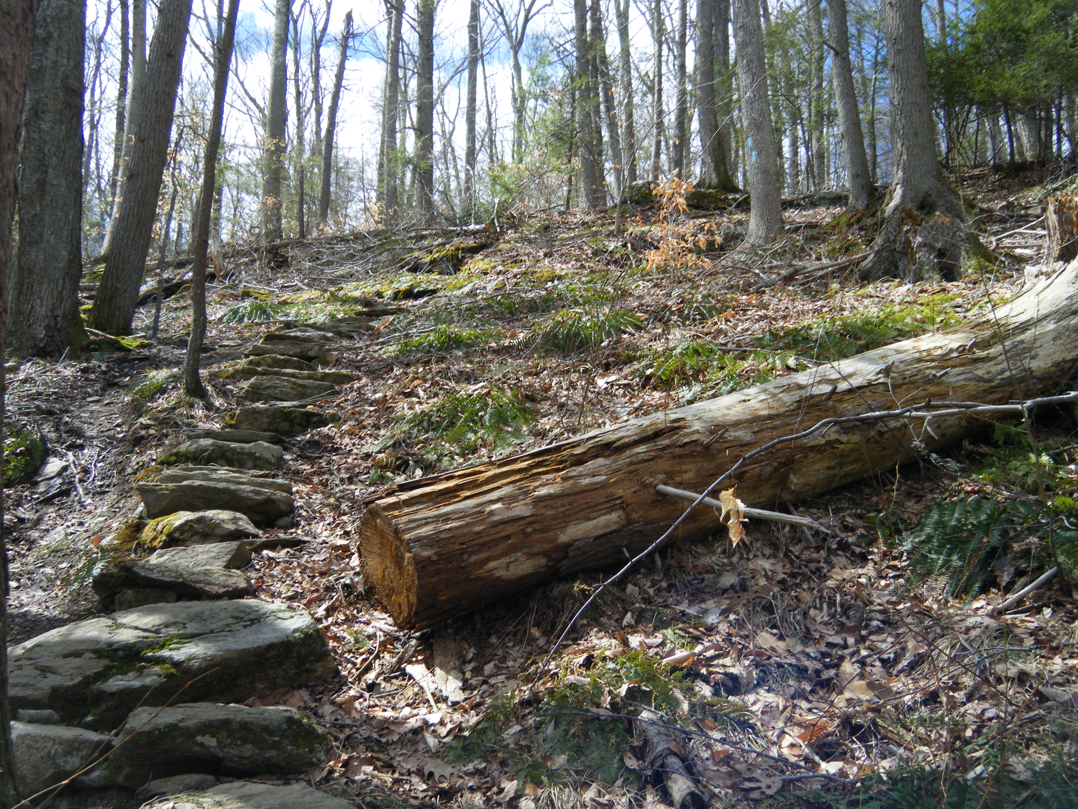
After returning to the main trail and crossing over Priton Brook with a log bridge, the trail meanders for about 0.7 miles until you take a sharp left turn and start heading uphill into the forest. A pretty challenging incline with some help from some strategically placed stepping stones.
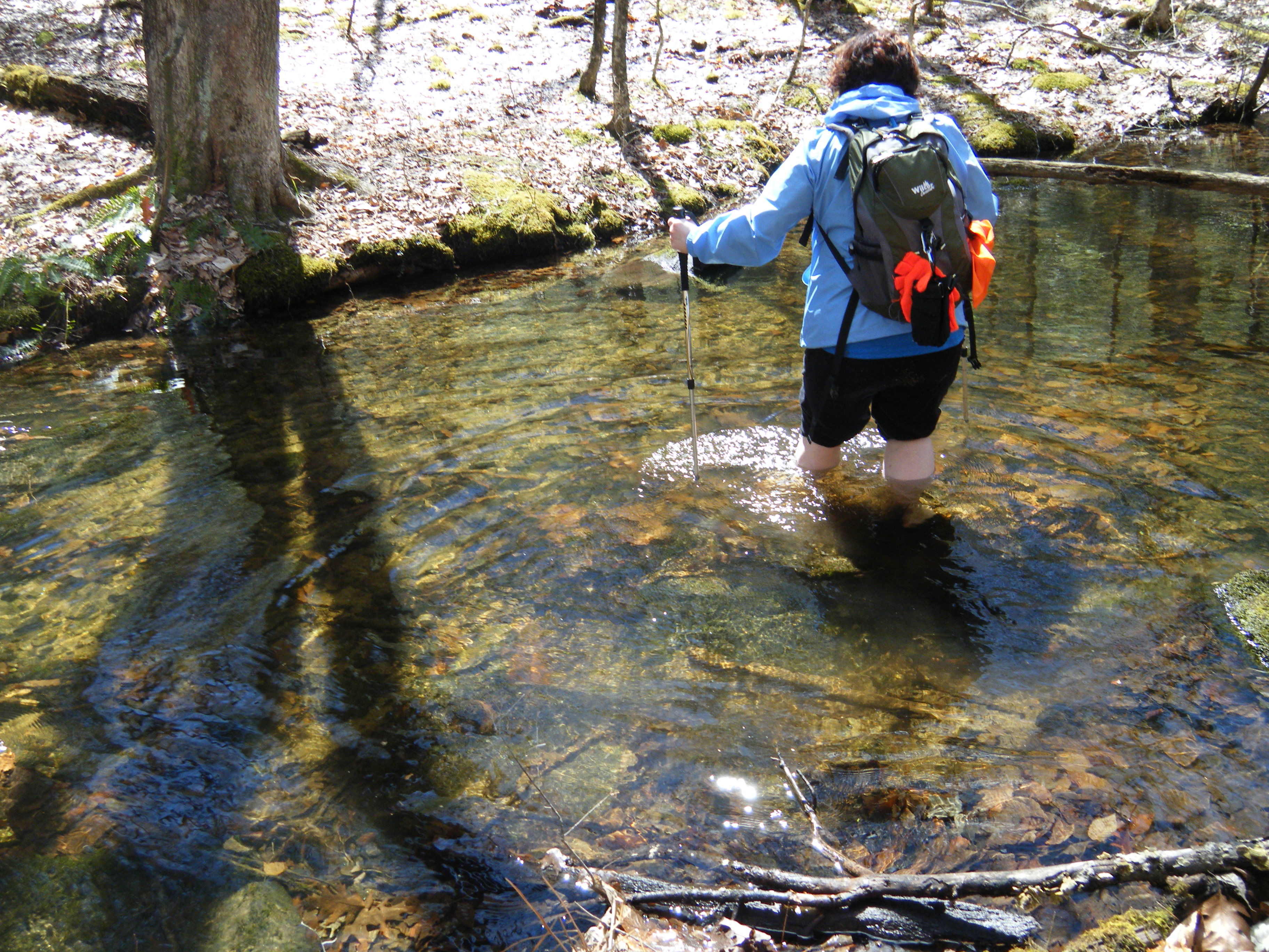
The trail follows the ridgeline and after the intersection with the blue-white trail start looking for a sharp left turn across Priton Brook. We missed this turn as the trail appeared to go straight ahead but after not seeing any blue blazes for awhile knew we must have missed a turn. After relocating the trail, it crosses Priton Brook. Because of the recent heavy rains the normal crossing over the brook was impassable because of the roaring water. There were a couple fallen trees that provided challenging bridges. My wife chose the alternative of taking her shoes and socks off and wading across in knee high water, very refreshing! (it looked like a permanent bridge was in the making, so look for that in the near future)
After this challenge the trail traverses numerous landscapes and intersects several side trails. We stayed on the main blue trail all the way back to the parking lot. All in all, an exhausting excursion that provided several challenges but many rewards of accomplishing them!
Don't forget to click on the video link at the top of this article for more images of the trail.
Hiking-Camping Gear available at EXCURSIONS Journey To Health

Take an Excursion Today! See more Intriguing Hiking Trails and Destinations in CT